|

WaterQualityWatch Maps
- To get real-time water quality maps showing on USGS WaterQualityWatch, use the following url:
http://waterwatch.usgs.gov/images/?g=wqw&p=<p_code:p00010,...>&st=<st>&w=<width>
where- <p_code> -- The USGS water quality parameter code. It can be one of
p00010 -- Water Temperature
p00095 -- Specific conductance.
p00400 -- pH
p00300 -- Dissolved Oxygen.
p00076 -- Turbidity - <st> -- A two-letter state abbreviation and 'us'.
- <width> -- The image width in pixels.
- <p_code> -- The USGS water quality parameter code. It can be one of
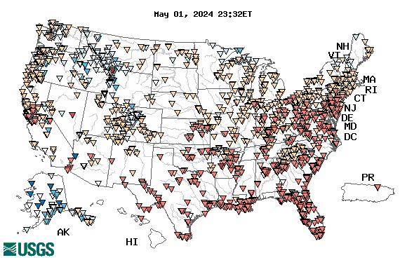
- Example 1: Real-time water temperature map for US: http://waterwatch.usgs.gov/images/?g=wqw&p=p00010&st=us
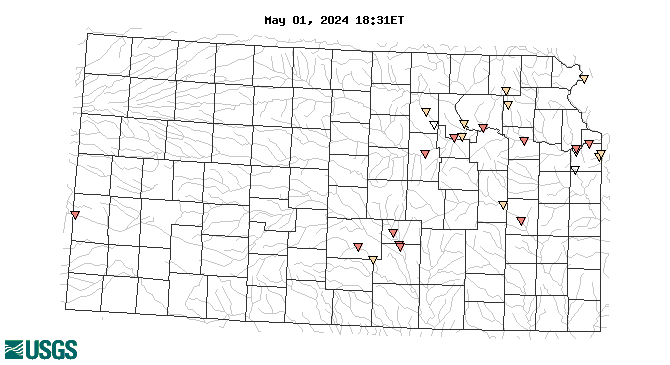
- Example 2: Real-time water temperature map for Kansas:
http://waterwatch.usgs.gov/images/?g=wqw&p=p00010&st=ks

![]() U.S. Department of the Interior |
U.S. Geological Survey
U.S. Department of the Interior |
U.S. Geological Survey
URL: https://waterwatch.usgs.gov
Page Contact Information: Contact USGS
Page Last Modified: Monday, January 5, 2026
http://waterwatch.usgs.gov/supports