Search
Search
USGS is updating how statistical information is delivered. WaterWatch and WaterQualityWatch will be retired around February 24, 2026.
Explore alternative tools
and share feedback at
wdfn@usgs.gov
.
WaterWatch
Map
|
HUC Map
|
Map (HCDN)
|
Summary Plot
|
Percent Summary
|
Summary Table
|
Dynamic Map
Your browser does not support JavaScript.
Map
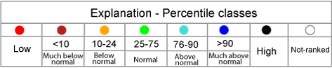
of daily streamflow compared to historical streamflow for the day of the year (New Hampshire)
New Hampshire
State
United States
Alabama
Alaska
Arizona
Arkansas
California
Colorado
Connecticut
Delaware
District of Columbia
Florida
Georgia
Hawaii
Idaho
Illinois
Indiana
Iowa
Kansas
Kentucky
Louisiana
Maine
Maryland
Massachusetts
Michigan
Minnesota
Mississippi
Missouri
Montana
Nebraska
Nevada
New Hampshire
New Jersey
New Mexico
New York
North Carolina
North Dakota
Ohio
Oklahoma
Oregon
Pennsylvania
Rhode Island
South Carolina
South Dakota
Tennessee
Texas
Utah
Vermont
Virginia
Washington
West Virginia
Wisconsin
Wyoming
Puerto Rico
or
Water-Resources Regions
01 New England
02 Mid Atlantic
03 South Atlantic-Gulf
04 Great Lakes
05 Ohio
06 Tennessee
07 Upper Mississippi
08 Lower Mississippi
09 Souris-Red-Rainy
10 Missouri
11 Arkansas-White-Red
12 Texas-Gulf
13 Rio Grande
14 Upper Colorado
15 Lower Colorado
16 Great Basin
17 Pacific Northwest
18 California
19 Alaska
20 Hawaii
21 Puerto Rico
Choose a data retrieval option and select a location on the map
List of all stations
Single station
Nearest stations
Peak flow
Home
Special Features
Current Streamflow
Flood
Drought
Past Flow/Runoff
Animation
Toolkit
Annual Summaries
Data Services
Additional Information
About WaterWatch