Search
Search
USGS is updating how statistical information is delivered. WaterWatch and WaterQualityWatch will be retired around February 24, 2026.
Explore alternative tools
and share feedback at
wdfn@usgs.gov
.
WaterWatch
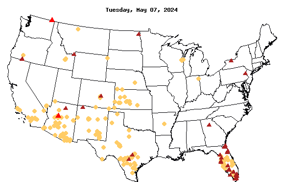
Record Low Flow Map
Map of Record Low 7-day Streamflow
Explanation
Record low flow with more than 30 years data
Record low flow with less than 30 years data
Zero flow sites
Retrieve Previous Map
(
No map available prior to 2012-08-24
)
Date (yyyymmdd):
Home
Special Features
Current Streamflow
Flood
Drought
Past Flow/Runoff
Animation
Toolkit
Annual Summaries
Data Services
Additional Information
About WaterWatch