USGS - science for a changing world

WaterQualityWatch -- Continuous Real-Time Water Quality of Surface Water in the United States

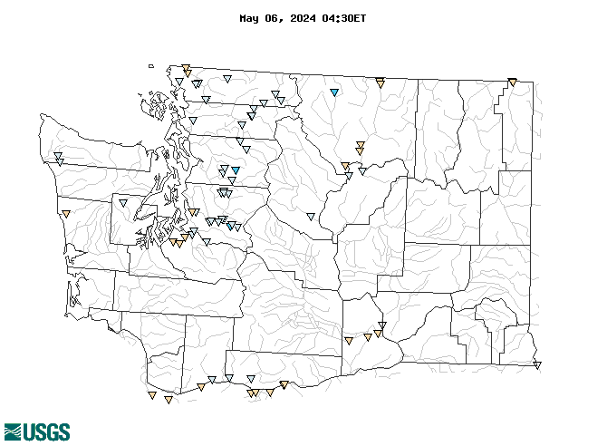
Real-Time Water Temperature, in °C

Map of , showing which states provide real-time computed water-quality data
12116100 14211720 12119000 12117500 12200500 14105700 12100490 454249120423500 14103000 12042800 1247351910 1203951610 12148500 12148300 12101100 12148000 12117600 12178000 12116500 12101102 12137800 12212050 14211400 12138160 12116400 12181000 12439500 13317660 12043000 12102078 12147500 12090400 12113390 12439000 12210900 12447390 12117000 12172000 12213100 12209490 12447200 12398600 12114500 12178150 12212430 12187500 12462500 12115000 12173500 12186000 12115500 12134500 12056500 12509489 12205000 12182500 12210700 12137290 12210000 12398550 12179900 12189500 12098700 453712121071200 453845121562000 12511800 12090500 12450650 12438000 12450480 12447302 454314120413701 453845121564001 12507573 12500450 Explanation

* Site operated on a seasonal basis or currently is not operating.
No values are available for the last 6 hours.

The "Real-time" map tracks short-term changes (over several hours) of water quality. Although the general appearance of the map changes very little from one hour to the next, individual sites may change rapidly in response to major rain events or to reservoir releases. The data used to produce this map are provisional.

Accessibility FOIA Privacy Policies and Notices

Take Pride in America logo USA.gov logo U.S. Department of the Interior | U.S. Geological Survey
URL: http://waterwatch.usgs.gov/wqwatch/map?state=wa&pcode=00010
Page Contact Information: gs-w-ks_info@usgs.gov
Page Last Modified: Mon 9 June 2014