USGS - science for a changing world

WaterQualityWatch -- Continuous Real-Time Water Quality of Surface Water in the United States

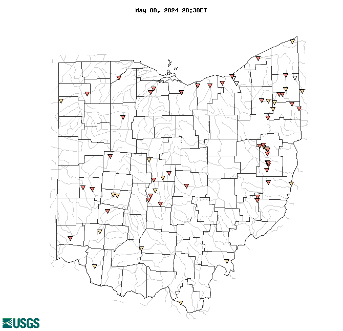
Real-Time Water Temperature, in °C

Map of , showing which states provide real-time computed water-quality data
04201500 04199000 03216070 04208509 04208000 03095500 03140950 03103500 03230427 03232470 03240000 412122083061400 04198000 04199500 03140900 04212100 04183500 03265000 03119341 04192500 04213000 03219500 03112500 04193500 03272100 04206425 395339083130100 03242350 03127989 03140853 04200500 04208504 03228039 03221500 03120820 03127980 03094704 03092090 03247041 03126395 03120961 03090500 03094000 03119979 03086500 03127986 03102950 03091500 03120869 03119971 411402080492400 04188496 03228805 03220510 03228300 03098600 03159540 03099500 03125338 03092460 03268100 04195500 04189000 Explanation

* Site operated on a seasonal basis or currently is not operating.
No values are available for the last 6 hours.

The "Real-time" map tracks short-term changes (over several hours) of water quality. Although the general appearance of the map changes very little from one hour to the next, individual sites may change rapidly in response to major rain events or to reservoir releases. The data used to produce this map are provisional.

Accessibility FOIA Privacy Policies and Notices

Take Pride in America logo USA.gov logo U.S. Department of the Interior | U.S. Geological Survey
URL: http://waterwatch.usgs.gov/wqwatch/map?state=oh&pcode=00010
Page Contact Information: gs-w-ks_info@usgs.gov
Page Last Modified: Mon 9 June 2014