USGS - science for a changing world

WaterQualityWatch -- Continuous Real-Time Water Quality of Surface Water in the United States

Real-Time Turbidity, in NTU or FNU

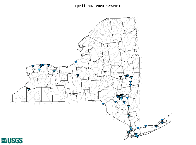
Map of , showing which states provide real-time computed water-quality data
04219915 01362232 04231600 04213500 04219768 0422016550 0135749950 01355475 01362368 01374019 01354330 01376515 01357500 0422018610 01362370 01362345 04220223 404028073384601 01302020 01362322 01363556 01434498 0135980207 0136219503 01311143 01362500 01362487 01362357 01304562 01362342 01362497 01304200 01362336 01304057 01376520 04249000 01362200 01359165 04220045 01362297 013621955 01427207 01364500 01372043 01304650 0136230002 01376307 0136235580 01362295 01362349 01362286 01362352 01310740 0136235585 0136219702 04218700 01362365 01362359 01362330 01349527 01362312 01362347 01342732 01376269 01362398 01362332 01362356 01351500 04236000 04218601 0136235575 Explanation

* Site operated on a seasonal basis or currently is not operating.
No values are available for the last 6 hours.

The "Real-time" map tracks short-term changes (over several hours) of water quality. Although the general appearance of the map changes very little from one hour to the next, individual sites may change rapidly in response to major rain events or to reservoir releases. The data used to produce this map are provisional.

Accessibility FOIA Privacy Policies and Notices

Take Pride in America logo USA.gov logo U.S. Department of the Interior | U.S. Geological Survey
URL: http://waterwatch.usgs.gov/wqwatch/map?state=ny&pcode=00076
Page Contact Information: gs-w-ks_info@usgs.gov
Page Last Modified: Mon 9 June 2014