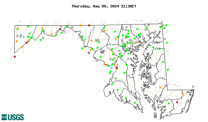
WaterQualityWatch -- Continuous Real-Time Water Quality of Surface Water in the United States

Real-Time Discharge, in cfs

Map of , showing which states provide real-time computed water-quality data
01646500 01638500 01636500 01613000 01611500 01601500 01651800 01619000 01597500 01490000 01483200 01585100 01645000 01643000 01639000 01614500 01610155 01610000 01609000 01604500 01596500 01593500 01591700 01591610 01589330 01589100 03076600 03076500 01595800 01595000 01594526 01491000 03078000 03075500 03066000 01661500 01661050 01660920 01658000 01653600 01653000 01652500 01650500 01649500 01648000 01646000 01643500 01639500 01638480 01637500 01619500 01617800 01603000 01599000 01598500 01595500 01594440 01594000 01592500 01591400 01591000 01589500 01589440 01589300 01589000 01586610 01586210 01586000 01585500 01585200 01584500 01584050 01583600 01583500 01583100 01582500 01582000 01581700 01581500 01580000 01578310 01495000 01493500 01493000 01488500 01486000 01485500 01485000 01479000 01478000 0158397967 0158175320 0148471320 03076100 03075905 03075850 03075825 01651730 01650800 01649190 01649150 01647850 01647600 01646305 01644390 01644388 01644380 01644375 01644372 01644371 01644280 01644148 01643395 01642199 01642198 01642190 01638420 01638350 01636690 01618100 01613525 01613095 01613020 01605002 01597490 01595790 01593450 01593370 01589795 01589352 01589320 01589317 01589316 01589315 01589312 01589290 01589230 01589197 01589035 01589025 01585219 01585104 01585090 01585075 01583800 01583580 01583570 01581960 01581920 01581870 01581830 01581810 01581752 01581750 01581649 01580700 01580620 01580520 01578475 01493112 01492500 01491500 01488110 01484701 01484696 01483155 01478650 01478245 Explanation

* Site operated on a seasonal basis or currently is not operating.
No values are available for the last 6 hours.

The "Real-time" map tracks short-term changes (over several hours) of water quality. Although the general appearance of the map changes very little from one hour to the next, individual sites may change rapidly in response to major rain events or to reservoir releases. The data used to produce this map are provisional.