USGS - science for a changing world

WaterQualityWatch -- Continuous Real-Time Water Quality of Surface Water in the United States

Real-Time Specific Conductance, in µS/cm
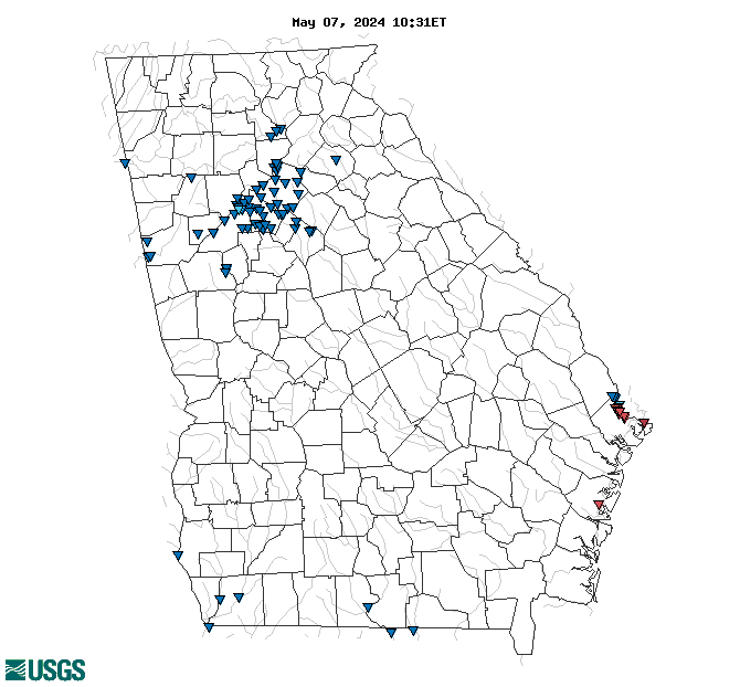
Map of , showing which states provide real-time computed water-quality data
021989773 02198980 022035975 021989715 0219897945 02198955 02198920 02198950 02336313 02413205 02397530 02357150 02207120 02336152 02205000 02204037 02208450 021989784 021989792 02388985 021989793 02198820 02337170 02335350 02394682 02217274 02336728 02336410 02208150 02205865 02334578 02208493 02335880 02317620 02206500 02218565 02203655 02336300 02334480 02203900 02336240 02217643 02336030 02198840 02356000 02207135 02344630 02337410 02388975 02207185 02203873 023362095 02207385 02344673 02198810 02336120 02343805 02203863 02203960 02319000 02336000 02336340 02335000 02318500 02413215 02358000 02334885 02336360 02207400 02203603 02203831 02207160 02203950 02336526 02389150 02413210 02203700 Explanation

* Site operated on a seasonal basis or currently is not operating.
No values are available for the last 6 hours.

The "Real-time" map tracks short-term changes (over several hours) of water quality. Although the general appearance of the map changes very little from one hour to the next, individual sites may change rapidly in response to major rain events or to reservoir releases. The data used to produce this map are provisional.

Accessibility FOIA Privacy Policies and Notices

Take Pride in America logo USA.gov logo U.S. Department of the Interior | U.S. Geological Survey
URL: http://waterwatch.usgs.gov/wqwatch/map?state=ga&pcode=00095
Page Contact Information: gs-w-ks_info@usgs.gov
Page Last Modified: Mon 9 June 2014