USGS - science for a changing world

WaterQualityWatch -- Continuous Real-Time Water Quality of Surface Water in the United States

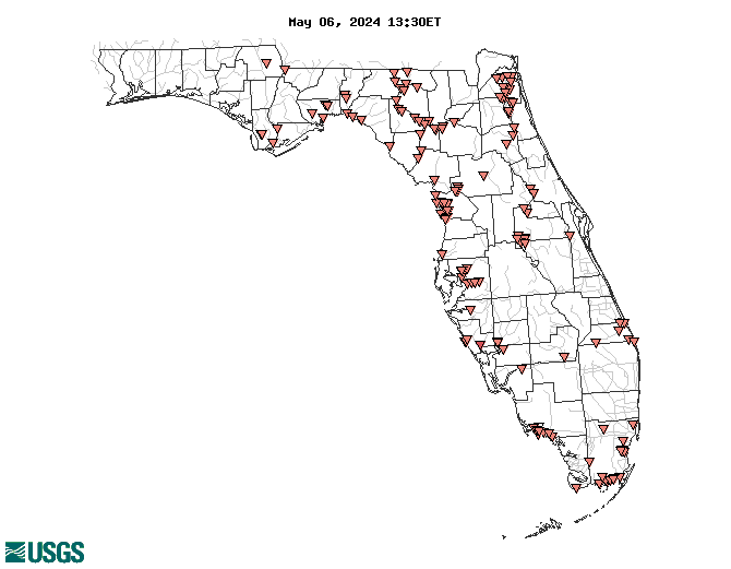
Real-Time Water Temperature, in °C

Map of , showing which states provide real-time computed water-quality data
251253080320100 251209080350100 02264100 02306028 02323502 251003080435500 02310678 02290709 02234600 02299730 02276998 02277100 022907085 251355080312800 02239501 02235500 02277744 02306000 02299260 255534081324000 02276877 255151080371501 02292900 251241080385300 02322500 02277110 265906080093500 02322800 02322700 02319520 02326516 02315626 250802081035500 0229070854 255432081303900 02321975 251433080265000 0229070825 02290930 02319302 255654081350200 02320250 255327081275900 02313100 02310743 02299735 02304510 02310740 023060003 02297350 02327022 02326526 0229070834 02297345 02301718 02304517 02358795 02286328 02310690 02234610 02310700 02321958 02292010 02327000 02299727 255138081321701 02319950 02310688 023060013 02298202 251457080395800 02299734 022908295 0229070836 265929080091800 02290928 02323566 02322400 254157080213800 02246804 02359223 02310750 285531082412600 02310308 02326050 022462002 295323085151700 02321500 02320000 301204081434900 301124081395901 295308085143700 302307083101400 02313272 02310673 02264051 02245340 02236000 285447082445100 02327100 02358000 02315550 302609081453300 023000095 02320500 301510081383500 02301721 02313700 294213081345300 02359170 02232400 02244040 02301500 02266291 02245290 02246518 02310742 02266200 02246751 02264000 02310674 02326550 02266300 02310663 02317620 302309081333001 02323000 02324170 02301635 302657081312400 301817081393600 02327031 02310712 02319000 02319800 300803081354500 295856081372301 301057081414800 02246500 02266495 02325543 02304000 02310752 251032080432200 02297460 251127080382100 Explanation

* Site operated on a seasonal basis or currently is not operating.
No values are available for the last 6 hours.

The "Real-time" map tracks short-term changes (over several hours) of water quality. Although the general appearance of the map changes very little from one hour to the next, individual sites may change rapidly in response to major rain events or to reservoir releases. The data used to produce this map are provisional.

Accessibility FOIA Privacy Policies and Notices

Take Pride in America logo USA.gov logo U.S. Department of the Interior | U.S. Geological Survey
URL: http://waterwatch.usgs.gov/wqwatch/map?state=fl&pcode=00010
Page Contact Information: gs-w-ks_info@usgs.gov
Page Last Modified: Mon 9 June 2014