WaterQualityWatch -- Continuous Real-Time Water Quality of Surface Water in the United States

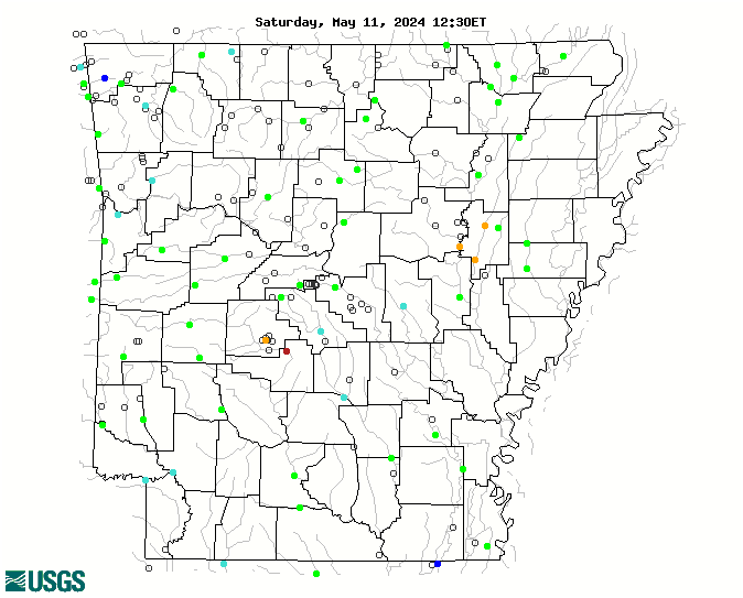
Real-Time Discharge, in cfs

Map of , showing which states provide real-time computed water-quality data
07369680 07048600 07077555 07077500 07069000 07047950 07047942 07358280 07337000 07056000 07050500 07364150 07363500 07363000 07361500 07356000 07257006 07075300 07348700 07077700 07077380 07072500 07064000 07363200 07362100 07359610 07341500 07341200 07264000 07252000 07069190 07049000 07366200 07364200 07364133 07362000 07359002 07340300 07340000 07261500 07261000 07258500 07257500 07249985 07249400 07247015 07247000 07196900 07195855 07195800 07195500 07195000 07191220 07077000 07076750 07075000 07074500 07072000 07069500 07060710 07060500 07053250 072632982 072632971 072632968 072632966 072632962 071948095 071912213 07367680 07364203 07364185 07364130 07364078 07364000 07363400 07363054 07362591 07362587 07362579 07362500 07360200 07359000 07358570 07358550 07358500 07358284 07358257 07358253 07358250 07355870 07355860 07346450 07344370 07341000 07340500 07339500 07265280 07263650 07263605 07263580 07263555 07263500 07263450 07263300 07263296 07263295 07263012 07263000 07261090 07260800 07260673 07260640 07260500 07258000 07257200 07256500 07251500 07250974 07250965 07250935 07250550 07250085 07249920 07249800 07249455 07247250 07195865 07195430 07195400 07194933 07194906 07194880 07194800 07191179 07191160 07189542 07189540 07077730 07076634 07076517 07075270 07074888 07074886 07074850 07074670 07074420 07074000 07069305 07069295 07069220 07064040 07064026 07061000 07060728 07059450 07058980 07057370 07056700 07056515 07055875 07055780 07055680 07055660 07055646 07055607 07054410 07053207 07050152 07048780 07048550 07047980 Explanation

* Site operated on a seasonal basis or currently is not operating.
No values are available for the last 6 hours.

The "Real-time" map tracks short-term changes (over several hours) of water quality. Although the general appearance of the map changes very little from one hour to the next, individual sites may change rapidly in response to major rain events or to reservoir releases. The data used to produce this map are provisional.