WaterQualityWatch -- Continuous Real-Time Water Quality of Surface Water in the United States

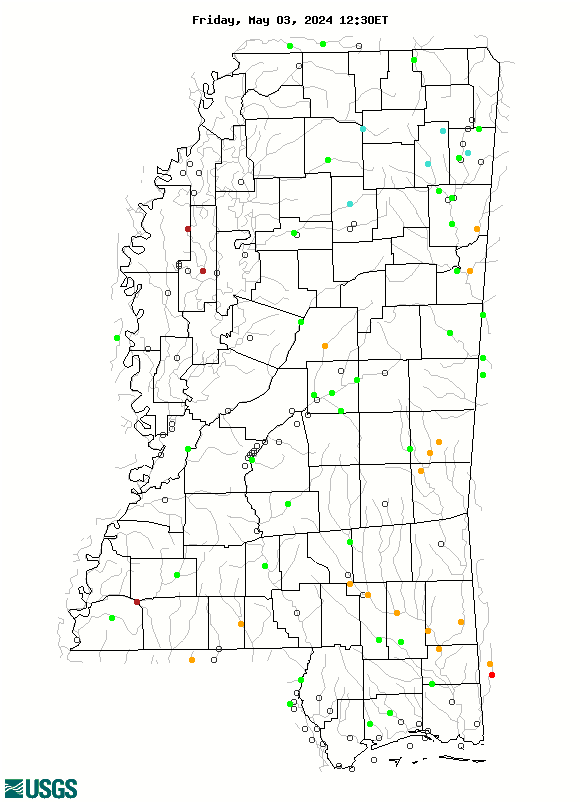
Real-Time Discharge, in cfs

Map of , showing which states provide real-time computed water-quality data
07369680 02486000 02479130 02481510 02479300 07290000 07030500 02448500 07295000 07291000 07290650 07288500 07029270 02490500 02489500 02481000 02479945 02479155 02479000 02475000 02472850 02441390 02435020 02433500 02431000 02430880 07375800 07292500 07289350 07288280 07285500 07283000 07274000 07268000 07032200 02492000 02488500 02487500 02484500 02484000 02483000 02482550 02482000 02479980 02478500 02477000 02476600 02476500 02475500 02474560 02473000 02472500 02472000 02448000 02444160 02443500 02439400 02437100 02436500 02430680 02430085 341550090391300 333601090450000 302318088512600 301849088350000 301429089145600 301141089320300 0248018020 07375300 07375280 07294800 07289730 07289000 07288939 07288800 07288650 07288580 07288521 07288068 07288048 07288000 07285400 07282100 07282000 07281600 07275900 07030392 02492620 02492600 02492519 02492511 02492360 02492343 02492100 02490200 02490193 02489000 02488000 02486350 02486100 02485950 02485820 02485810 02485800 02485700 02485601 02485600 02485498 02484760 02484650 02484600 02483500 02482470 02481880 02481660 02481521 02481299 02481130 02480590 02479310 02477500 02472980 02444161 02437000 02433496 02432500 02431011 02430626 02430161 02430005 Explanation

* Site operated on a seasonal basis or currently is not operating.
No values are available for the last 6 hours.

The "Real-time" map tracks short-term changes (over several hours) of water quality. Although the general appearance of the map changes very little from one hour to the next, individual sites may change rapidly in response to major rain events or to reservoir releases. The data used to produce this map are provisional.