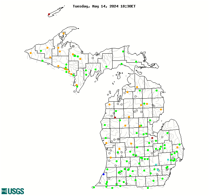
WaterQualityWatch -- Continuous Real-Time Water Quality of Surface Water in the United States

Real-Time Discharge, in cfs

Map of , showing which states provide real-time computed water-quality data
04172000 04157005 04155500 04121500 04166300 04166100 04163400 04148500 04106400 04105700 04060500 04043050 04176000 04135700 04101000 04040500 04031000 04099750 04174500 04167000 04164300 04161820 04148140 04142000 04133501 04128990 04113000 04112500 04109000 04108800 04104945 04095300 04062000 04001000 04176500 04164500 04127917 04126740 04125460 04124000 04122500 04122200 04121300 04116000 04115000 04114000 04102700 04097540 04057800 04057510 04056500 04046000 04045500 04041500 04037500 04184500 04173500 04166500 04165500 04164100 04164000 04161000 04160600 04159900 04159492 04156000 04154000 04152500 04152238 04151500 04150500 04149000 04147500 04146063 04146000 04145000 04144500 04136500 04136000 04127997 04127800 04124500 04122100 04119000 04118500 04117500 04115265 04114498 04112000 04111379 04111000 04108600 04106320 04106000 04105500 04105000 04103500 04102500 04101800 04101500 04101370 04099000 04097500 04096515 04096405 04067500 04066800 04065722 04065106 04064500 04063000 04062500 04062011 04060993 04059500 04059000 04058100 04057814 04057813 04040000 04036000 04033000 450415085153501 445512084415301 442805084411001 040975299 05390100 04176400 04174518 04168580 04168400 04167625 04166700 04165710 04164800 04159130 04157060 04150800 04148440 04148295 04137500 04137005 04136900 04127885 04127200 04126970 04125550 04124200 04122025 04122001 04121970 04121944 04119400 04119055 04118105 04118000 04117004 04116500 04112850 04108862 04108660 04107850 04106500 04101535 04098980 04097188 04096015 04095380 04069416 04066030 04065650 04063522 04058200 04058190 04057812 04057811 04044755 04044090 04044003 04043244 04043238 04043150 04043097 04043016 04037400 04035995 Explanation

* Site operated on a seasonal basis or currently is not operating.
No values are available for the last 6 hours.

The "Real-time" map tracks short-term changes (over several hours) of water quality. Although the general appearance of the map changes very little from one hour to the next, individual sites may change rapidly in response to major rain events or to reservoir releases. The data used to produce this map are provisional.